What is El Caminito del Rey?
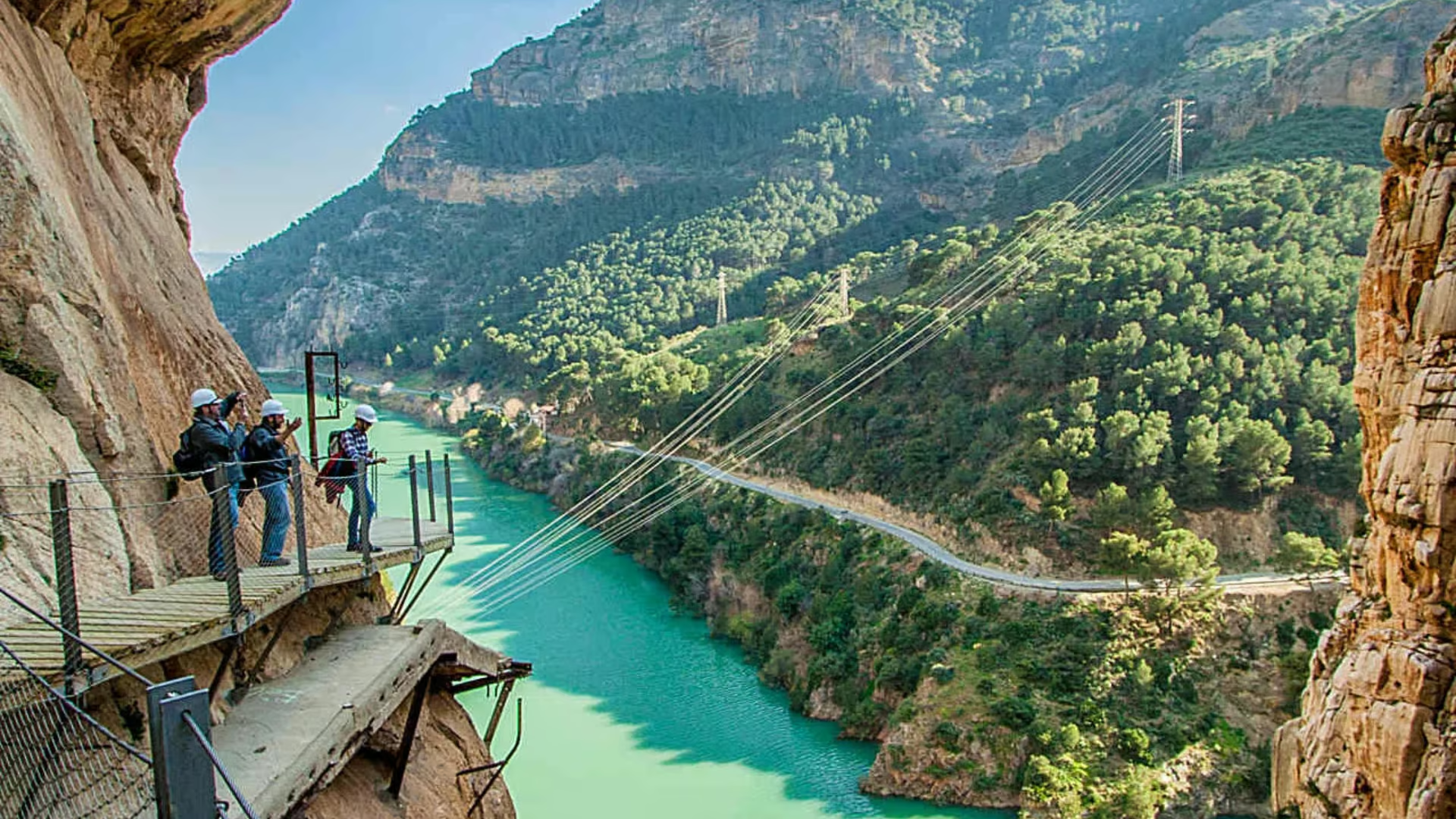
El Caminito del Rey consists of a footbridge over three kilometers long. This walkway clings to the rock face inside a canyon, with sections barely one meter wide, hanging up to 105 meters above the river. The route is located in the Desfiladero de los Gaitanes Natural Park, between the municipalities of Ardales, Álora, and Antequera.
Until its restoration in 2015, it was considered ‘the most dangerous route in the world’ due to its poor condition and lack of railings. After its restoration, it is now a safe pathway.
History of El Caminito del Rey
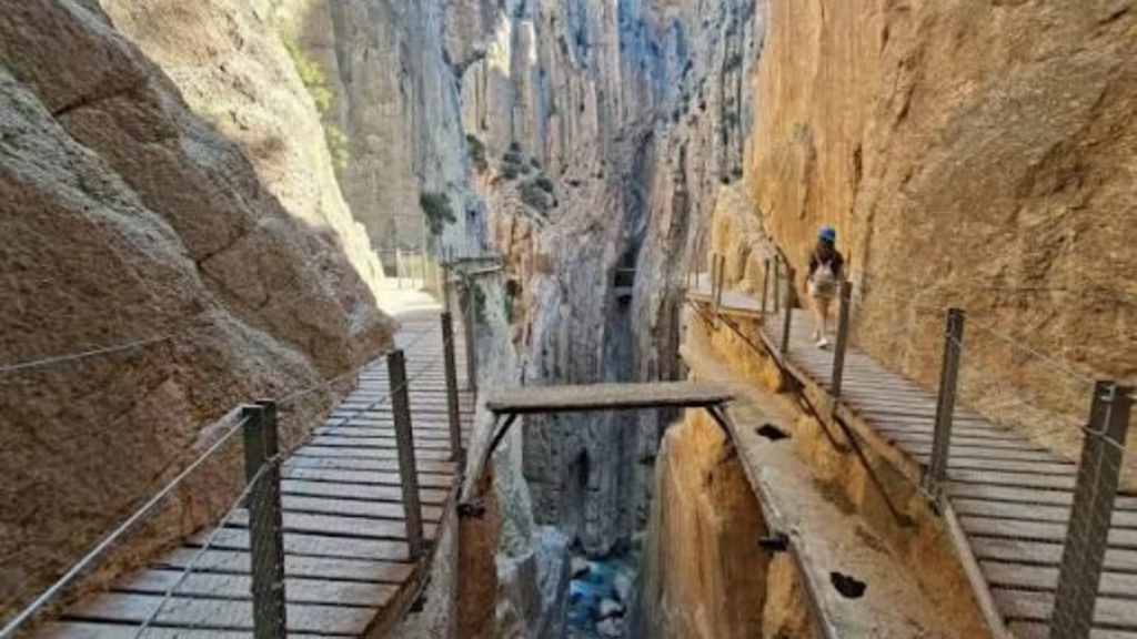
El Caminito del Rey originated with a practical function at the beginning of the 20th century. The Chorro Hydroelectric Company needed access between the Gaitanejo and El Chorro waterfalls to facilitate the passage of maintenance workers and the transport of animals.
In 1921, King Alfonso XIII inaugurated the Guadalhorce reservoirs and crossed the pathway, which gave rise to its popular name. Over time and due to poor maintenance, the path deteriorated. In 1999 and 2000, after several fatal accidents, the regional government of Andalusia closed access to it in 2001. In 2014, restoration work began, and it was opened to the public in March 2015.
Where is El Caminito del Rey and how to get there?
El Caminito del Rey is located in the center of the province of Málaga, less than 60 kilometers from the capital. The Visitor Reception Center is located at Puerto de las Atalayas, 6 kilometers from the Ardales junction.
How to get there:
- By car: from Málaga take the A-357 to the Ardales junction, where you then take the MA-5403.
- By train: Renfe provides regional trains that stop at El Chorro station.
How to get tickets for El Caminito del Rey
Tickets to walk El Caminito del Rey can be obtained through the official website. It is essential to book the day and time in advance.
Prices and different types of tickets:
- General admission: €10. Allows you to do the tour on your own.
- Official guided tour: €18. Maximum group of 30 people, available in Spanish or English.
- Shuttle bus: €2.50 (round trip, paid in cash to the driver).
- Parking: €2 per day.
This route has a number of restrictions: children under 8 years old are not allowed access, and those over 8 years old must present their original ID to verify their age.
The Caminito del Rey route: stages and duration
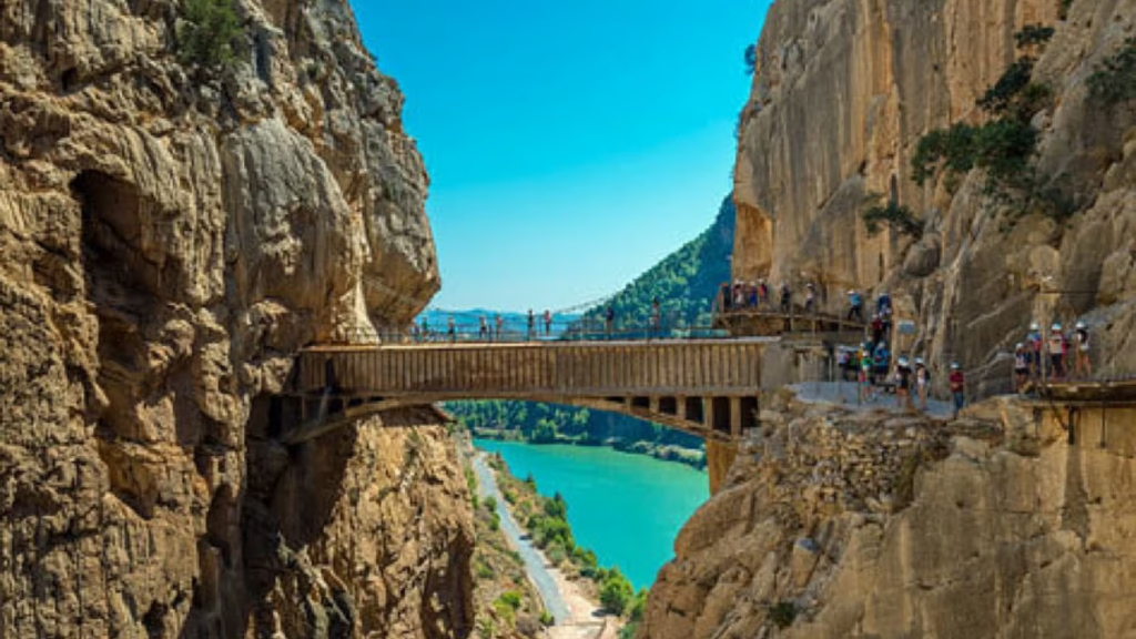
El Caminito del Rey has a length of 7.7 kilometers, of which 4.8 are access paths and 2.9 are walkways. A helmet, which is mandatory, is provided at the start of the route.
Highlights of the route:
- North access: from the illuminated 1.5-kilometer tunnel to the entrance.
- Gaitanejo Reservoir: the first part of the route along the water.
- Gaitanejo Dam: the start of the hanging walkways.
- King’s Bridge: emblematic point of the route.
- Balcony of the Gaitanes: viewpoint with a glass floor at 400 meters high.
- Suspension bridge: at 105 meters high.
- Exit at El Chorro (Álora): where the equipment is returned.
Frequently asked questions about The Caminito del Rey
Is The Caminito del Rey dangerous nowadays?
No. After its rehabilitation in 2015, El Caminito del Rey is completely safe. The walkways have been reinforced, there are railings, and the helmet is mandatory to protect visitors.
How long does it take to complete the route?
Between 3 and 4 hours, including the access paths and the shuttle bus ride. The walkway section itself takes approximately 1.5 to 2 hours.
Can you go with dogs?
No. For safety reasons, access with pets is not allowed.